Tropical Storm Warning Issued Along North Carolina Coast as Hurricane Erin Approaches
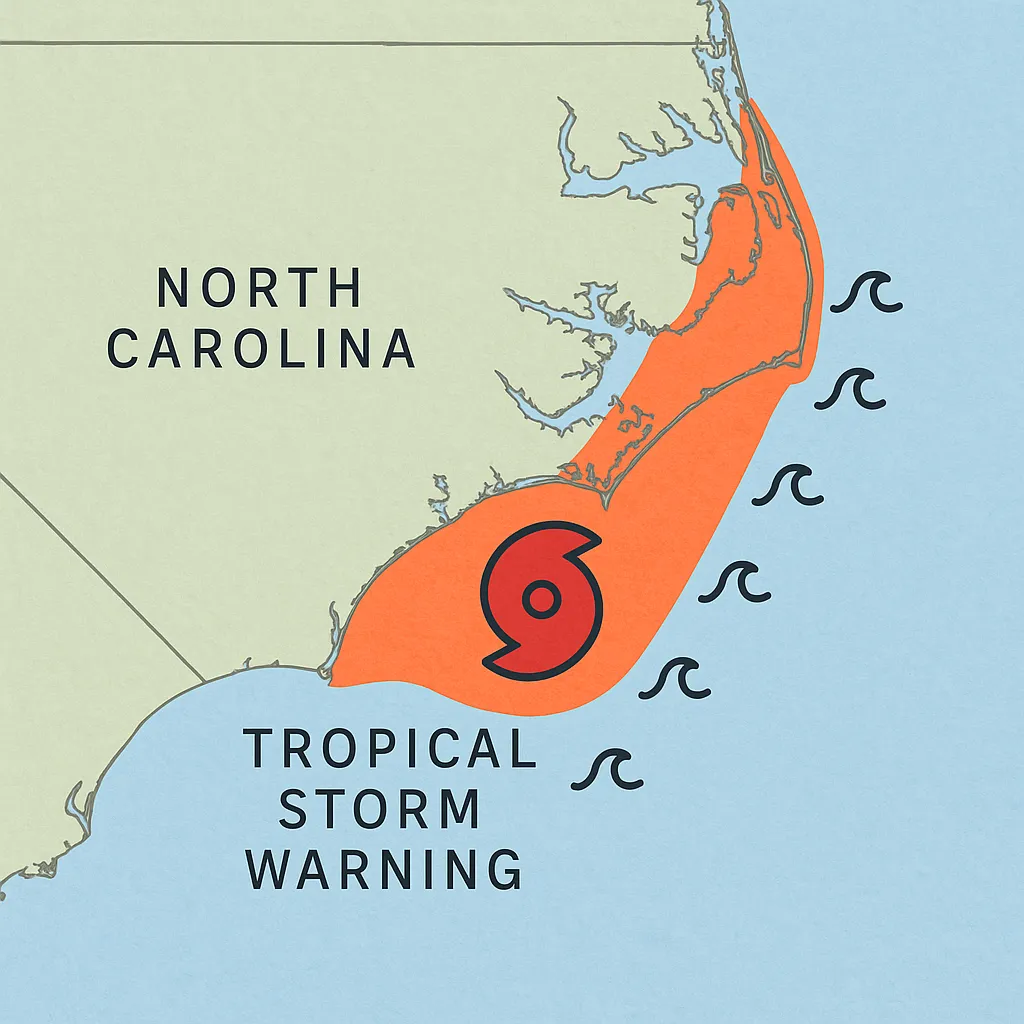
Wilmington, NC, August 20, 2025 – The National Hurricane Center has issued a Tropical Storm Warning. This warning affects the North Carolina coast from Beaufort Inlet to Duck, including Pamlico and Albemarle Sounds. Hurricane Erin’s outer bands are bringing strong winds and serious risks to the area.
A Storm Surge Warning is in effect from Cape Lookout to Duck. This warns residents about the risk of fast coastal flooding during high tide in the next 36 hours. Winds in the warning area may reach 39–73 mph. Gusts could be stronger as Erin heads north-northwest toward the Outer Banks.
On Tuesday, Governor Josh Stein announced a State of Emergency. He called in the National Guard and set up shelters for coastal residents and visitors. Mandatory evacuations are still in effect for Ocracoke and Hatteras Islands. Local officials urge all residents in the warning zone to: - Secure property - Prepare emergency kits - Follow evacuation orders promptly Don’t delay!
The storm’s strong winds are creating dangerous rip currents and high surf. This has led to “no swimming” advisories at beaches from Wrightsville Beach to the north. The National Weather Service warns that Erin’s eye will remain offshore. Yet, its strong waves and currents will last until midweek. This means serious risks for swimmers and small craft operators.
Officials advise that:
- Coastal flooding may occur during back-to-back high tides. This is especially true near inlets and communities along the sound front.
- Beach erosion could be significant as waves exceed 15 feet in some locations.
- Power outages and downed trees are possible in lower-lying areas.
Residents need to keep an eye on updates from their local National Weather Service. They should also listen to all instructions from emergency management agencies as Hurricane Erin travels near the U.S. East Coast.
Categories
Business and finance Climate Entertainment Food and drink Games Health Hobbies and leisure Jobs and education Law and government Other Politics Science Sports TechnologyRecent Posts
Tags