Northwest Arkansas Sees First Taste of Fall as Record Heat Gives Way to Showers
FAYETTEVILLE, AR (August 25, 2025) - Northwest Arkansas experienced a dramatic swing in weather today as record summer heat gave way to the region’s first taste of fall and widespread showers.
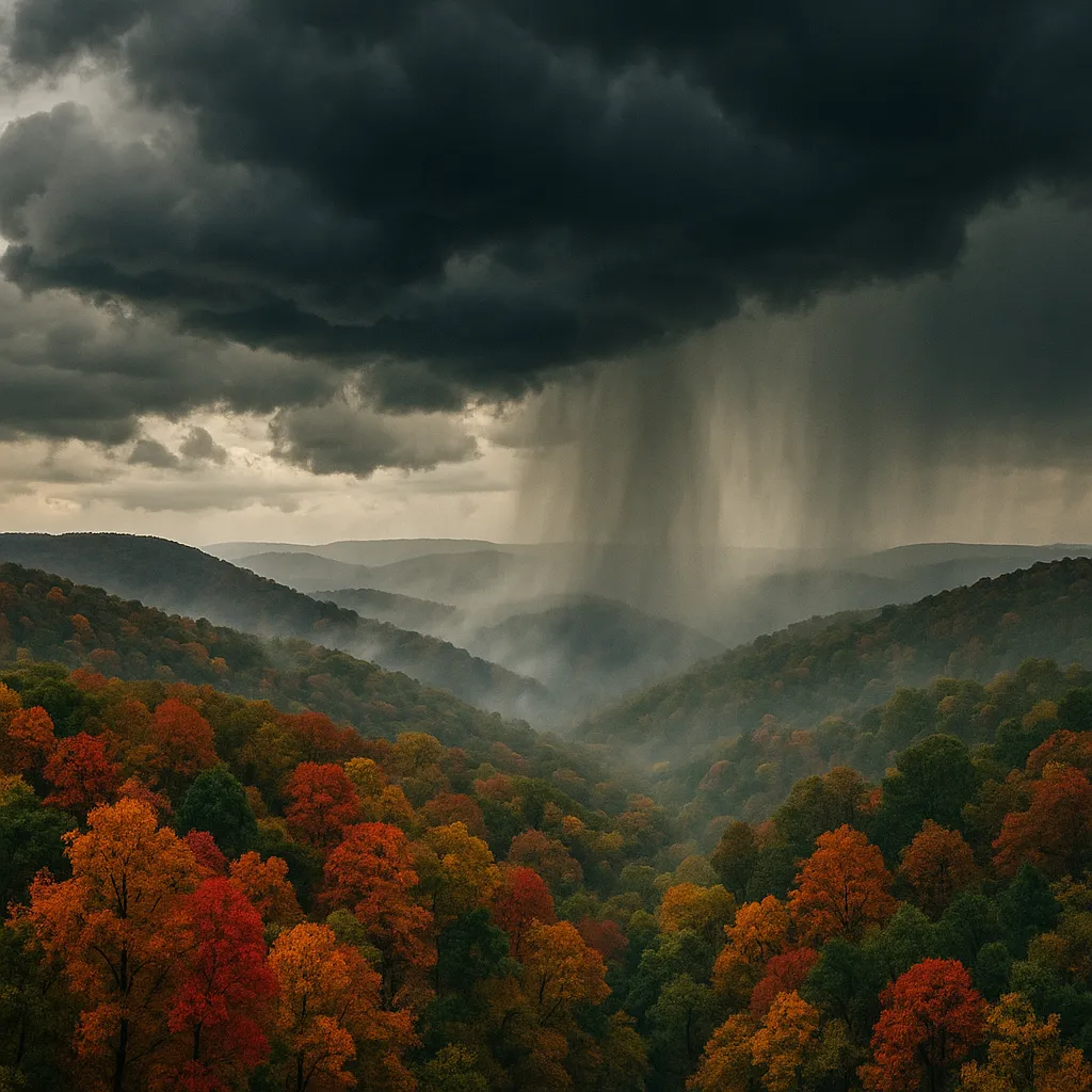
At midday, temperatures soared to what meteorologists believe to be the hottest of the year so far, with several River Valley communities flirting with 100°F before late-day cloud cover began to build. By mid-afternoon, a cold front advancing from the Ozark highlands ushered in showers and cooler air, marking a sharp contrast to the intense heat earlier in the day.
“Our first taste of fall has arrived across the Ozarks, along with widespread showers,” the KNWA & FOX24 weather team reported on social media. Radar imagery showed rain moving in from northwest to southeast beginning around 3:00 p.m., and scattered thunderstorms developed by early evening. Forecasters say overnight lows will dip into the mid-60s, offering relief after a sustained summer heat wave.
Looking ahead, the chance for additional rain returns late tomorrow as the fall-like pattern continues. Highs on Wednesday are expected to remain in the low 80s, nearly 15 degrees cooler than today’s peak, with scattered showers persisting through the afternoon. The extended forecast calls for continued below-normal temperatures and periodic rain through the end of the week.
- KNWA News Formatting Team
Sources: “Our first taste of fall has arrived across the Ozarks…” KNWA & FOX24 Instagram, August 25, 2025. KNWA & FOX24 (@KNWAFOX24) X post, August 25, 2025.
Categories
Beauty and fashion Business and finance Climate Entertainment Food and drink Games Health Hobbies and leisure Jobs and education Law and government Other Politics Science Shopping Sports Technology Travel and transportationRecent Posts
Tags