Tornado Warnings Issued Across Multiple States on August 28, 2025
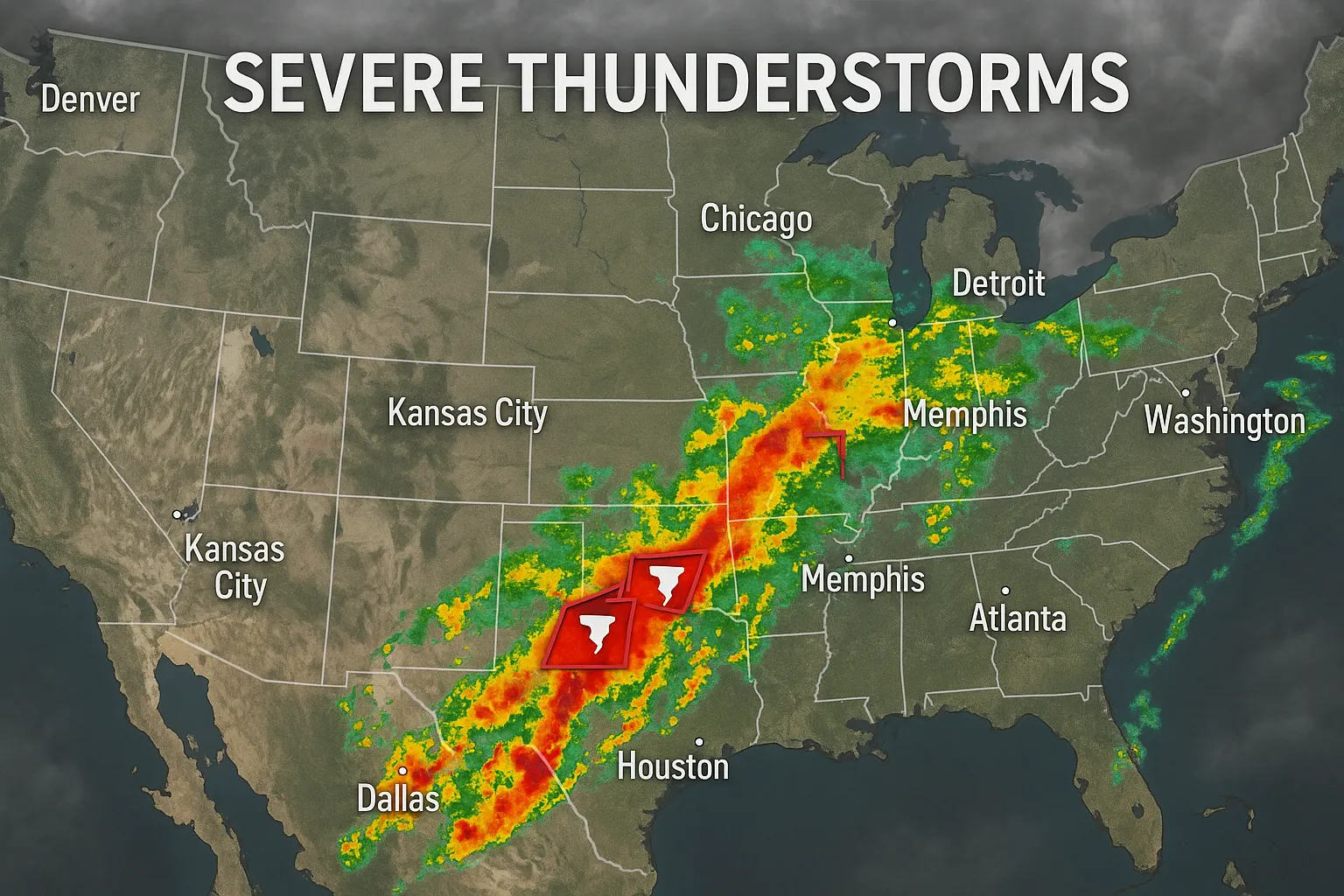
WASHINGTON, D.C., August 28, 2025 (AP) - The National Weather Service (NWS) issued a series of tornado warnings today as severe thunderstorms capable of producing tornadoes moved through the central and eastern United States. Throughout the afternoon and evening hours, warnings were activated from the Plains to the Upper Midwest and parts of the Northeast.
Western Plains and Great Plains
In Oklahoma, severe storms developed ahead of a slow-moving cold front. The NWS issued tornado warnings for Beaver County as storms tracked eastward:
- At 10:57 PM CDT, a severe thunderstorm capable of producing a tornado was located 7 miles west of Knowles, moving east at 20 mph.
- Earlier at 5:54 PM MDT, a warning covered Kiowa County after a storm 11 miles southeast of Haswell shifted southwest at 15 mph【2】.
Scattered severe thunderstorms with a low-end tornado threat were anticipated across central Oklahoma during the late afternoon, with quarter-size hail and gusts up to 65 mph possible in affected cells【10】.
Upper Midwest
Western Minnesota experienced multiple warnings tied to rotating thunderstorms:
- A confirmed tornado touched down 9 miles west of Canby at about 8:45 PM CDT, prompting shelter-in-place orders for residents in and around Canby; the warning for Yellow Medicine County remained in effect until 9:00 PM.
- A radar-indicated warning was issued at 8:33 PM for areas just west of Willmar, covering Chippewa, Kandiyohi and Swift counties through 9:15 PM.
- Additional tornado warnings spanned Big Stone, Traverse, Roberts, Waseca, Faribault, Martin and Kossuth counties as storms progressed east-southeastward, some with storm motion as high as 35 mph【2】.
Northeast
In New York State, two tornado warnings were issued in the early afternoon:
- At 2:08 PM EDT, a storm over Cato, Cayuga County, prompted a warning valid until 3:00 PM.
- At 1:20 PM EDT, a warning covered Lyons in Wayne County, with the storm moving northeast at 25 mph【2】.
Southeast
A tornado warning was briefly in effect for Duval County, Florida, beginning at 6:02 PM EDT near Bayard (Mandarin area), though it expired without reports of confirmed touchdowns【2】.
Outlook and Safety Advice
The Storm Prediction Center maintains a Slight Risk for severe weather across parts of the central Plains into the Upper Midwest tomorrow, with scattered strong to severe thunderstorms possible. Residents in warned areas are urged to monitor NOAA Weather Radio and local media for updates, seek shelter in interior rooms away from windows, and have multiple ways to receive warnings as storms develop.
- END -
Categories
Autos and vehicles Beauty and fashion Business and finance Climate Entertainment Food and drink Games Health Hobbies and leisure Jobs and education Law and government Other Politics Science Shopping Sports Technology Travel and transportationRecent Posts
Tags