Tampa, FL (August 31, 2025) - Weather Impact Alert Issued as Late-Morning Storms Sweep In
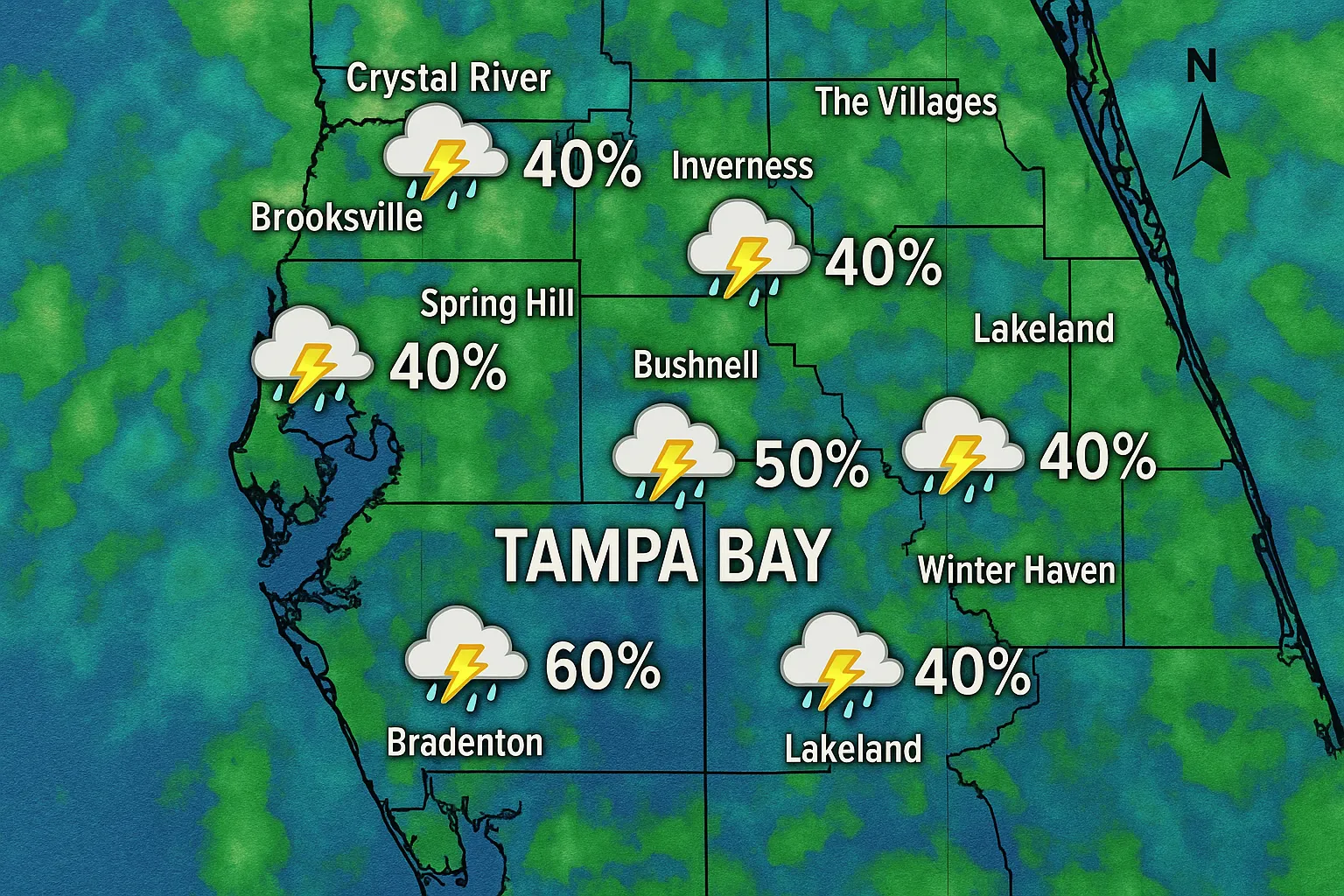
A Weather Impact Alert was in effect across the Tampa Bay region from 11 a.m. to 6 p.m. on Sunday, August 31st, as a cold front sagged southward, drawing scattered thunderstorms onshore.
Morning and early-afternoon downpours developed along the westerly sea-breeze boundary, with the highest rain-chance between 11 a.m. and 2 p.m. Meteorologists warned of locally heavy showers capable of producing up to one inch of rainfall in isolated cells, raising concerns for ponding on roadways and slick driving conditions.
By mid-afternoon, the storm activity began to wane under a tightening pressure gradient. Rain chances dropped from around 60 percent at noon to roughly 20 percent after 3 p.m., with showers becoming increasingly isolated. Skies cleared further after 6 p.m., offering a window for outdoor evening plans and grilling.
Temperatures peaked in the upper 80s, with daytime highs reaching 88 °F and humidity levels remaining high enough to fuel convective development despite northerly wind components behind the front. No severe‐weather reports of hail or tornadoes were recorded, though localized lightning and gusty winds were noted in stronger cells.
Looking ahead, forecasters anticipate drier and more stable conditions overnight into Monday, before moisture returns later in the Labor Day holiday period. No tropical systems of concern were present in the Gulf or Atlantic as of this afternoon, affording residents a brief respite from stormy weather into the evening hours.
Categories
Autos and vehicles Beauty and fashion Business and finance Climate Entertainment Food and drink Games Health Hobbies and leisure Jobs and education Law and government Other Politics Science Shopping Sports Technology Travel and transportationRecent Posts
Tags