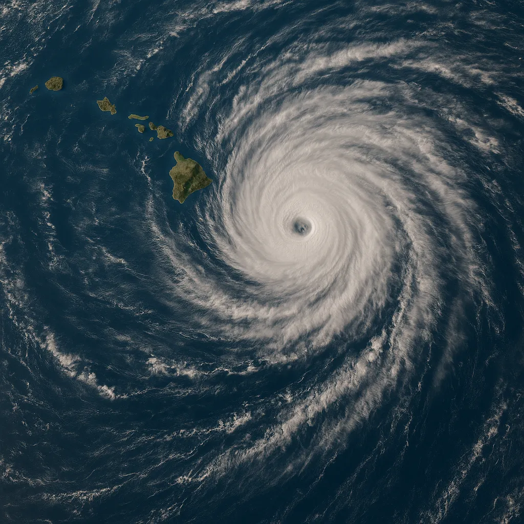
Hurricane Kiko Weakens Slightly, Continues Westward Toward Hawaii

Honolulu, HI - September 5, 2025
Hurricane Kiko, the powerful storm churning in the eastern Pacific, has weakened to a Category 3 hurricane but remains a threat to the Hawaiian Islands early next week.
As of 5 p.m. Hawaiian Standard Time on September 4, Kiko’s maximum sustained winds decreased to near 125 mph, down from Category 4 intensity, as it tracked westward at approximately 9 mph. The storm’s eye was centered about 1,360 miles east-southeast of Hilo, according to the National Hurricane Center advisory.
Despite the slight weakening, forecasters caution that Kiko may re-strengthen briefly before gradually losing power over cooler waters and encountering increasing wind shear later this weekend. The hurricane’s compact wind field extends hurricane-force gusts up to 25 miles from its center, with tropical-storm-force winds reaching outward as far as 80 miles.
No tropical watches or warnings are currently in effect for the Hawaiian Islands. However, mariners and coastal residents should prepare for large swells and dangerous surf conditions as Kiko’s swells begin to impact the state by late weekend. The National Hurricane Center issued Advisory 20 early this morning confirming the storm’s slight weakening but emphasizing that interests in Hawaii should continue to monitor the system’s progress.
Forecasters project that Kiko will maintain a generally west-northwestward track and could approach the Hawaiian archipelago by Tuesday or Wednesday. Residents are urged to review hurricane plans, secure loose outdoor items, and stay informed through official updates as conditions evolve.
Categories
Autos and vehicles Beauty and fashion Business and finance Climate Entertainment Food and drink Games Health Hobbies and leisure Jobs and education Law and government Other Politics Science Shopping Sports Technology Travel and transportationRecent Posts
Tags
Archives
08/19/2025 (3) 08/20/2025 (40) 08/21/2025 (27) 08/22/2025 (22) 08/23/2025 (4) 08/24/2025 (21) 08/25/2025 (30) 08/26/2025 (24) 08/27/2025 (29) 08/28/2025 (16) 08/29/2025 (9) 08/30/2025 (13) 08/31/2025 (17) 09/01/2025 (167) 09/02/2025 (124) 09/03/2025 (149) 09/04/2025 (112) 09/05/2025 (72) 09/06/2025 (169) 09/07/2025 (162) 09/08/2025 (150) 09/09/2025 (176) 09/10/2025 (194) 09/11/2025 (194) 09/12/2025 (186) 09/13/2025 (207) 09/14/2025 (159) 09/15/2025 (175) 09/16/2025 (198) 09/17/2025 (196) 09/18/2025 (196) 09/19/2025 (207) 09/20/2025 (129) 09/21/2025 (4)