Hurricane Kiko Weakens Slightly, Approaches Hawaiian Islands
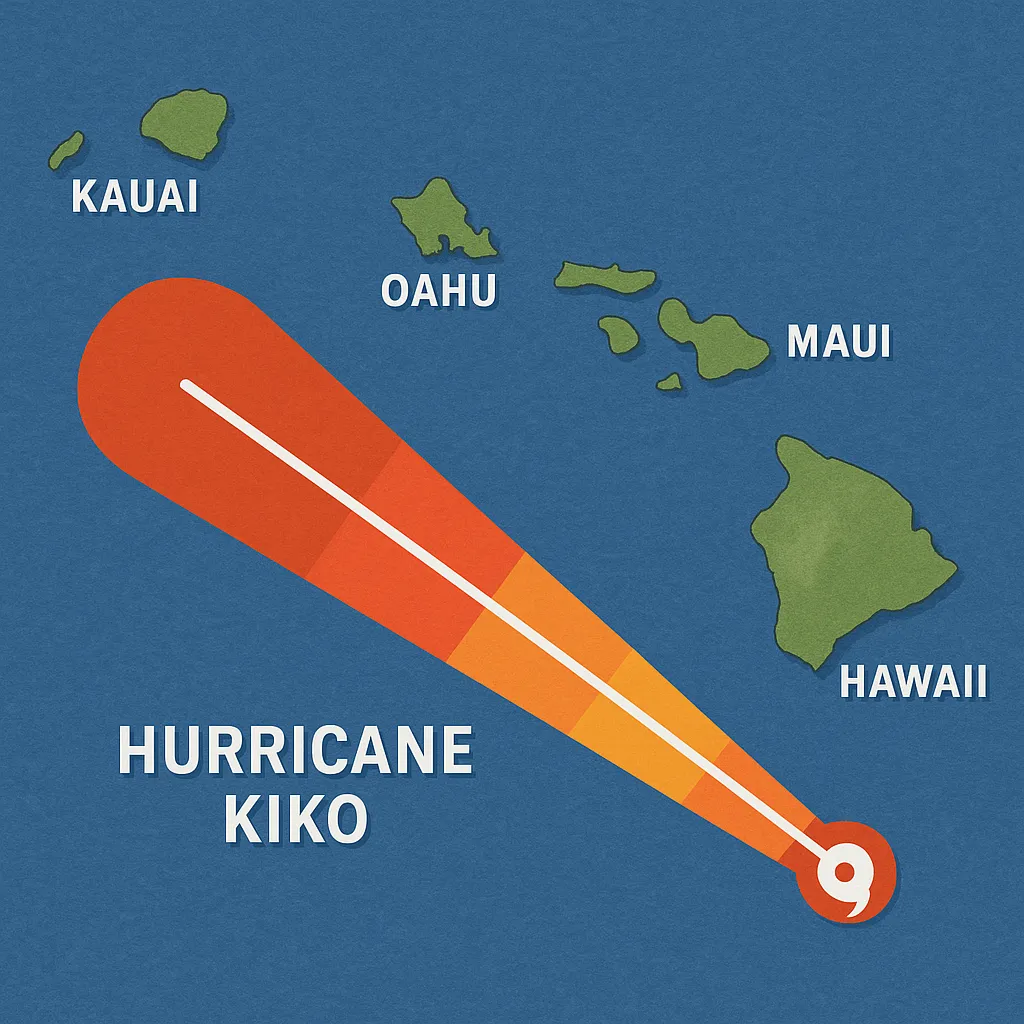
HONOLULU - Today, forecasters continued to track Hurricane Kiko, which has begun a gradual weakening trend as it nears the Hawaiian Islands. The National Hurricane Center issued Advisory 20 at 5 p.m. HST, reporting that Kiko’s maximum sustained winds had fallen to 125 mph, classifying it as a Category 3 storm on the Saffir-Simpson scale.
The storm was centered near latitude 13.9° N, longitude 135.4° W-approximately 1,360 miles east-southeast of Hilo-and was moving west at 9 mph. A turn toward the west-northwest is expected tonight, with a gradual increase in forward speed forecast through the weekend.
Although no coastal watches or warnings are currently in effect, Hawaiʻi residents and visitors are advised to monitor official updates closely. Swells generated by Kiko could begin impacting island shores by the end of the weekend, producing life-threatening surf and rip currents.
On local television this morning, KHON2 meteorologists confirmed the downgrade to Category 3 and noted that Kiko is expected to re-strengthen to a Category 4 before crossing into the Central Pacific basin tomorrow evening. Models project that a weakened tropical storm could make its closest approach near the Big Island by Monday night or Tuesday, with tropical-storm-force gusts of around 60 mph possible.
The National Weather Service in Honolulu warned that moisture associated with Kiko may lead to heavier showers and potential flooding in higher elevations early next week, urging communities to prepare emergency kits and review evacuation plans.
Key Points:
- Maximum sustained winds: 125 mph (Category 3)
- Movement: west at 9 mph; turn west-northwest expected tonight
- No watches or warnings in effect; residents should continue monitoring updates
- Swells and rip currents likely by weekend; flash-flood risk in higher terrain early next week
- Forecast closest approach north of islands as a tropical storm on Monday night-Tuesday
Residents are encouraged to secure loose outdoor items, verify emergency supplies, and stay tuned to the National Hurricane Center and local forecasts for any watch or warning upgrades.
Categories
Autos and vehicles Beauty and fashion Business and finance Climate Entertainment Food and drink Games Health Hobbies and leisure Jobs and education Law and government Other Politics Science Shopping Sports Technology Travel and transportationRecent Posts
Tags
Archives
08/19/2025 (3) 08/20/2025 (75) 08/21/2025 (67) 08/22/2025 (76) 08/23/2025 (101) 08/24/2025 (96) 08/25/2025 (218) 08/26/2025 (197) 08/27/2025 (198) 08/28/2025 (194) 08/29/2025 (183) 08/30/2025 (177) 08/31/2025 (179) 09/01/2025 (180) 09/02/2025 (188) 09/03/2025 (175) 09/04/2025 (179) 09/05/2025 (31)