Coastal Storm Triggers Flood Warning Along Mid-Atlantic Coast
Lead: A potent coastal storm prompted the National Weather Service to issue a Coastal Flood Warning Monday for sections of North Carolina and Virginia, forecasting up to 2 feet of inundation and dangerous surf through Tuesday.
Nut Graf: As remnants of a decaying low pressure system drift northward off the Carolinas, communities from the Outer Banks to the Virginia Tidewater face rising tides, coastal flooding and hazardous marine conditions at summer’s end.
Coastal Inundation and Surf Conditions
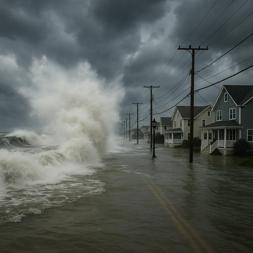
- Coastal waters along the ocean- and sound-sides of the Outer Banks are forecast to see 1-2 feet of flooding above ground level, threatening low-lying roads and waterfront properties.
- Breakers of 6-9 feet will create coastal erosion and beach overtopping under a High Surf Advisory extending northward from Hatteras.
Gale and Small Craft Advisories
- Gale Warnings are in effect for all offshore waters except inland rivers, with gusts of 40-45 mph and seas peaking at 7-12 feet offshore.
- Local Small Craft Advisories begin late Monday night and continue through Tuesday night for coastal bays and sounds, with northeast winds sustained at 20-25 knots and gusts up to 35 knots.
Timeline of Impacts
- Monday Night: East to northeast winds of 15-20 knots gusting to 30 knots; tide levels rising toward peak flood thresholds near high tide.
- Tuesday: Winds strengthen to 20-25 knots with gusts to 35 knots; continued heavy surf, coastal flooding risk highest around dawn high tide.
- Tuesday Night: Gale conditions persist offshore; rainfall and isolated thunderstorms may exacerbate flooding in coastal communities.
- Wednesday: Winds diminish gradually, but minor flooding could linger in vulnerable low-lying areas.
Public Safety and Preparedness
Residents and visitors are urged to avoid driving on inundated roadways, secure outdoor furniture, and monitor local tide gauges. Boaters should heed marine advisories and remain in safe harbor until conditions improve. Emergency managers advise that flood-prone areas stay clear of tidal creeks and waterfront promenades until the storm system departs.
Categories
Autos and vehicles Beauty and fashion Business and finance Climate Entertainment Food and drink Games Health Hobbies and leisure Jobs and education Law and government Other Politics Science Shopping Sports Technology Travel and transportationRecent Posts
Tags
Archives
08/19/2025 (3) 08/20/2025 (40) 08/21/2025 (27) 08/22/2025 (22) 08/23/2025 (4) 08/24/2025 (21) 08/25/2025 (30) 08/26/2025 (24) 08/27/2025 (29) 08/28/2025 (16) 08/29/2025 (9) 08/30/2025 (13) 08/31/2025 (17) 09/01/2025 (167) 09/02/2025 (124) 09/03/2025 (149) 09/04/2025 (112) 09/05/2025 (72) 09/06/2025 (169) 09/07/2025 (162) 09/08/2025 (150) 09/09/2025 (176) 09/10/2025 (194) 09/11/2025 (194) 09/12/2025 (186) 09/13/2025 (207) 09/14/2025 (159) 09/15/2025 (175) 09/16/2025 (198) 09/17/2025 (196) 09/18/2025 (196) 09/19/2025 (207) 09/20/2025 (129) 09/21/2025 (4)