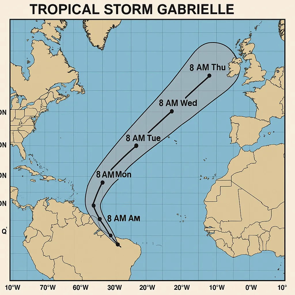
Gabrielle Set to Intensify as It Tracks Offshore

Tropical Storm Gabrielle is churning in the central Atlantic, approximately 845 miles east of the Northern Leeward Islands, moving west-northwest at 15 mph with sustained winds of 50 mph, and is forecast to become a hurricane by early next week.
Gabrielle’s remote position belies its potential impact, as forecasters warn that rapid intensification could push the storm toward Bermuda and disrupt maritime travel during what remains an active Atlantic hurricane season.
Current Conditions
- Location: 845 miles east of the Northern Leeward Islands
- Movement: West-northwest at 15 mph
- Sustained Winds: 50 mph (with higher gusts)
- Central Pressure: 1004 mb
Forecast and Implications
- Forecasters expect little change in strength over the next 48 hours, followed by gradual intensification late this weekend.
- Gabrielle is projected to reach hurricane strength (≥ 74 mph) by early next week.
- No coastal watches or warnings are currently in effect, but Bermuda interests should monitor updates.
Potential Hazards
- Elevated seas and swells across open Atlantic shipping lanes.
- Possible rip currents and elevated surf along Bermuda’s coastline if the storm veers northward.
- Disruptions to marine operations and offshore platforms in the central Atlantic.
Outlook and Monitoring
- Steering Factors: A subtropical ridge to the north is expected to guide Gabrielle on a west-northwest to northwest trajectory before a likely turn toward the north or northeast late in the weekend.
- Environmental Challenges: Gabrielle currently contends with westerly wind shear and dry air, which may slow initial intensification.
- Next Advisories: The National Hurricane Center will issue the next public advisory by this afternoon, with updated track and intensity forecasts.
Residents in Bermuda and mariners in the central and western Atlantic should review preparedness plans and maintain awareness of official advisories as Gabrielle evolves.
Categories
Autos and vehicles Beauty and fashion Business and finance Climate Entertainment Food and drink Games Health Hobbies and leisure Jobs and education Law and government Other Politics Science Shopping Sports Technology Travel and transportationRecent Posts
Gunman Arrested After Country Club Wedding Shooting in Nashua
Trump, Vance Honor Charlie Kirk at Massive Arizona Funeral
DOJ Closes Bribery Probe into Border Czar Tom Homan
Bad Bunny Concludes Puerto Rico Residency with Star-Studded Amazon Livestream
Multiple Shot, Including One Fatality, at Sky Meadow Country Club
Bad Bunny Delivers Historic “Una Más” Livestream Finale from Puerto Rico
‘28 Years Later’ Arrives on Netflix, Three Months After Theatrical Debut
Cyberattack Snarls Check-In Systems at Major European Airports
Premier League Sees Upsets as Liverpool Edges Everton
Chelsea’s Adarabioyo Drafted In After Sanchez Sent Off at Old Trafford
Superman Premieres on HBO Linear Tonight as Streaming Hit
Southern Skies to Darken: Partial Solar Eclipse Looms Tomorrow
Venus’s Square with Uranus Fuels Independence in Today’s Horoscopes
Dublin Airport’s Terminal 2 Evacuated and Reopened After Security Alert
Tell me what happened today 09/20/2025: “tcu” and write it in news format in English.
Clemson University Dismisses Three Employees After Free Speech Controversy
Braun Strowman Unveils USA Network Series and Horror Sequel Role
Noem Launches National ICE Initiative via Social Media
Binance Implements Margin and Leverage Adjustments on September 20, 2025
Spurs Salvage Late Draw at Brighton
Tags
Archives
08/19/2025 (3) 08/20/2025 (40) 08/21/2025 (27) 08/22/2025 (22) 08/23/2025 (4) 08/24/2025 (21) 08/25/2025 (30) 08/26/2025 (24) 08/27/2025 (29) 08/28/2025 (16) 08/29/2025 (9) 08/30/2025 (13) 08/31/2025 (17) 09/01/2025 (167) 09/02/2025 (124) 09/03/2025 (149) 09/04/2025 (112) 09/05/2025 (72) 09/06/2025 (169) 09/07/2025 (162) 09/08/2025 (150) 09/09/2025 (176) 09/10/2025 (194) 09/11/2025 (194) 09/12/2025 (186) 09/13/2025 (207) 09/14/2025 (159) 09/15/2025 (175) 09/16/2025 (198) 09/17/2025 (196) 09/18/2025 (196) 09/19/2025 (207) 09/20/2025 (129) 09/21/2025 (4)