Gabrielle Gains Strength, Set to Pass East of Bermuda and Generate Hazardous Swells
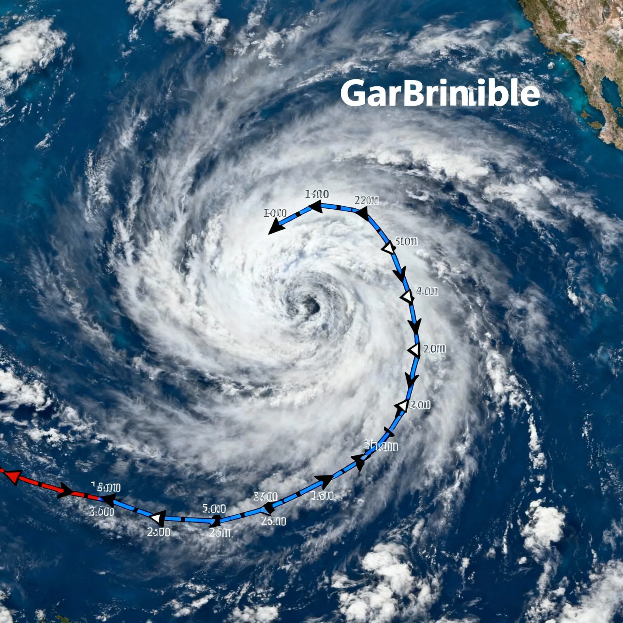
Tropical Storm Gabrielle intensified today in the central Atlantic, with sustained winds rising to 60 mph as it organizes under diminishing shear, and is forecast to become a hurricane by Sunday while tracking well east of Bermuda.
Nut Graf Gabrielle’s steady strengthening highlights the active peak of the 2025 hurricane season and underscores the threat of large swells and rip currents along Bermuda and the U.S. East Coast, even without a direct landfall.
Storm Organization and Forecast Track
- Intensity Increase: Satellite and aircraft data confirm better-defined curved banding and a forming mid-level eye, leading forecasters to raise Gabrielle’s winds to 60 mph.
- Hurricane Formation: Models show Gabrielle entering a low-shear, moist environment, enabling it to reach hurricane status by Sunday, potentially peaking near 105 mph later in the forecast period.
- Recurve East of Bermuda: The National Hurricane Center anticipates Gabrielle will recurve northward between a subtropical ridge and an approaching trough, passing at least 130 nautical miles east of Bermuda Sunday night into Monday.
Hazards to Watch
- Life-Threatening Swells: Swells generated by Gabrielle are already building off Bermuda and will propagate northward along the U.S. Atlantic coast, creating dangerous surf and rip currents through early next week.
- Marine and Coastal Risks: While tropical-storm-force winds remain offshore, mariners and beachgoers should heed advisories from the Bermuda Weather Service and U.S. coastal agencies due to rising seas and shifting currents.
Preparing for Impacts
Local authorities in Bermuda and U.S. coastal states recommend:
- Monitoring official forecasts from the National Hurricane Center and Bermuda Weather Service.
- Avoiding all marine activities when swells exceed safe thresholds.
- Heeding lifeguard warnings and posted flags at beaches to reduce rip current fatalities.
As Gabrielle tracks through open waters, its primary dangers will be indirect-powerful swells, rough surf, and rip currents-serving as a reminder that even storms that remain offshore can pose significant hazards to maritime and coastal communities.
Categories
Autos and vehicles Beauty and fashion Business and finance Climate Entertainment Food and drink Games Health Hobbies and leisure Jobs and education Law and government Other Politics Science Shopping Sports Technology Travel and transportationRecent Posts
Tags
Archives
08/19/2025 (3) 08/20/2025 (40) 08/21/2025 (27) 08/22/2025 (22) 08/23/2025 (4) 08/24/2025 (21) 08/25/2025 (30) 08/26/2025 (24) 08/27/2025 (29) 08/28/2025 (16) 08/29/2025 (9) 08/30/2025 (13) 08/31/2025 (17) 09/01/2025 (167) 09/02/2025 (124) 09/03/2025 (149) 09/04/2025 (112) 09/05/2025 (72) 09/06/2025 (169) 09/07/2025 (162) 09/08/2025 (150) 09/09/2025 (176) 09/10/2025 (194) 09/11/2025 (194) 09/12/2025 (186) 09/13/2025 (207) 09/14/2025 (159) 09/15/2025 (175) 09/16/2025 (198) 09/17/2025 (196) 09/18/2025 (196) 09/19/2025 (207) 09/20/2025 (129) 09/21/2025 (4)