Hatteras Island: A Comprehensive Overview
Hatteras Island is the longest barrier island in the contiguous United States. It stretches about 68 km (42 mi) along North Carolina’s Outer Banks. Pamlico Sound separates the Atlantic Ocean from the coast. It is filled with history, unique ecosystems, and a lively culture. This makes it a key spot for ecology and a great place for fun.
Geography and Physical Setting
Hatteras Island sits next to the North Carolina mainland. It is a key part of the Outer Banks. Although about 68 km long, the island rarely exceeds 1 km in width, narrowing in spots to mere hundreds of meters. It bends at Cape Point near Buxton. This “elbow” splits the island’s north- and south-facing beaches. The Herbert C. Bonner (“Old”) Oregon Inlet Bridge connects it to the mainland to the north. To the south, there’s a ferry system at Hatteras Village.
Its slender profile makes Hatteras exceptionally dynamic. Barrier islands form through the mix of waves, tides, wind, and storms. Hatteras is no different. Seasonal nor’easters and hurricanes have hit the island many times. They create temporary inlets and reshape the dunes. The island covers about 85.6 km² (33 sq mi). However, it is eroding. Some areas have lost up to 75% of their original width since the mid-20th century. This is mainly due to rising sea levels and changes in sediment transport.
The island’s west side meets the shallow Pamlico Sound, which is brackish. Its east side looks out at the changing shoals of the Atlantic Ocean. These conditions result in a variety of habitats: maritime forests, sand dunes, salt marshes, and tidal flats. Each one is home to unique plants and animals.
Geological Origins and Processes
Hatteras Island has developed over the last few million years. Its sediments are a result of sea-level changes caused by glaciers. During glacial periods, sea levels dropped. This exposed coastal plain sediments. Then, during interglacial periods, rising sea levels submerged and reworked these sediments. The barrier islands we have today are made up of sand bodies formed by cycles of deposition and erosion. Cape Hatteras has a notable bend due to longshore currents. These currents deposit sand in a curved shape. Later, returning currents flow back toward the mainland.
Indigenous Peoples and Early Settlement
Before Europeans came, the Croatoan tribe lived on the island. They called the main village “Croatoan,” which is today Buxton. Archaeological evidence shows people have lived here since at least 500 AD. Native communities relied on shellfish, fish, game, and coastal plants for food. Their midden deposits, made up of oyster and clam shells, are still visible in some spots. They show the long history of settlement in the area.
The Lost Colony of Roanoke, founded in 1587, disappeared under strange circumstances. Records from that time mention “Croatoan.” This has led to ideas that some survivors moved to Hatteras Island and lived with the Croatoans. Recent finds, like a 16th-century English ring near Buxton, support these ideas. However, clear proof is still hard to find.
European Colonization and Maritime Heritage
By the early 1700s, English settlers Patrick Mackuen and William Reed built the first recorded European homesteads. These tough communities relied on fishing, farming, and boat piloting. They faced limited resources and harsh winters. Live oaks, known for ship repair, used to blanket the island. However, heavy logging took away most of the trees.
Hatteras’s perilous surrounding waters earned it the moniker “Graveyard of the Atlantic.” Diamond Shoals and shifting sandbanks caused problems. The warm Gulf Stream meets the cold Labrador Current here. This mix led to over 2,000 shipwrecks from the 16th to the 20th century. In August 1861, Union forces captured Fort Hatteras and Fort Clark. This was the U.S. Navy’s first big amphibious win. It led to years of coastal blockades and ship battles.
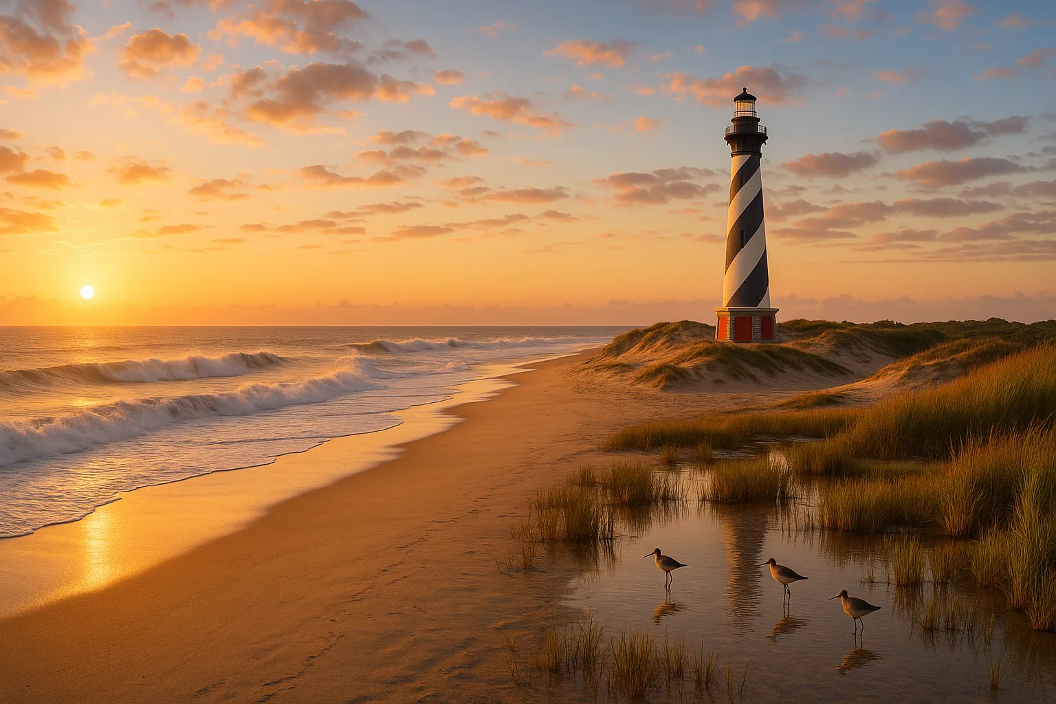
To reduce shipwrecks, the U.S. Life-Saving Service set up stations along the coast in the 1870s. The famous Cape Hatteras Lighthouse was lit for the first time in 1803. The structure we see today was built in 1870. In 1999, it was moved 880 m inland to avoid erosion. It represents both the risks of the sea and the strength of the coast.
Cape Hatteras National Seashore and Conservation
Cape Hatteras National Seashore, the first national seashore in the U.S., was established in 1937. It includes Hatteras, Bodie, and Ocracoke Islands. The National Park Service manages this area. It protects over 70 km of shoreline, maritime forests, and dunes. Visitors can enjoy campgrounds, nature trails, and sound-side access ramps.
Pea Island National Wildlife Refuge is right by the seashore, 13 miles north of Hatteras Village. It was created in 1938 to protect migratory birds, threatened sea turtles, and other wildlife. It covers 2,750 ha of dunes, brackish ponds, and marshes. This area hosts over 370 bird species, like greater snow geese and neotropical migrants. You can also find sea turtles and migratory waterfowl here. Observation platforms, trails like the North Pond Wildlife Trail, and a visitor center make it easy to view wildlife and learn about the environment.
Further south, you’ll find Buxton Woods Coastal Reserve. It protects the biggest area of maritime evergreen forest on the Atlantic coast. This reserve includes relic dunes, shrub swamps, and a diverse range of plants and animals. It’s great for birdwatching and studying ecology.
Climate and Natural Hazards
Hatteras Island enjoys a humid subtropical climate. Winters are mild, averaging about 14 °C in January. Summers are hot and humid, with July highs reaching around 31 °C. Its open location is hit by nor’easters, tropical storms, and hurricanes. These storms can flood low areas, cause overwash, and alter the dunes. Coastal erosion is a big threat. It’s caused by sea-level rise, which happens at about 3 mm a year. This affects our buildings, wildlife, and cultural sites.
Communities and Cultural Life
Hatteras Island has seven main communities, listed from north to south: Rodanthe, Waves, Salvo (the “Tri-Village”), Avon, Frisco, Buxton, and Hatteras Village. Each retains a distinctive character:
- Rodanthe, Waves, and Salvo are known for their quiet beaches and surf fishing. They also feature the famous “WAVES SALVO RODANTHE” art installation, which is set against stunning ocean views.
- Avon: Located near Frisco to the south and Tri-Village to the north. It offers kiteboarding on Pamlico Sound and surfing in the ocean.
- Frisco has local shops and galleries. It also offers direct access to the beaches of Cape Hatteras National Seashore.
- Buxton is the largest community. It hosts government offices and schools. It’s also near the fishing beaches at Cape Point.
- Hatteras Village is a historic maritime hub and commercial center. It’s known as the “Blue Marlin Capital of the World” for its offshore game fishing tournaments.
The island’s culture mixes maritime traditions such as commercial fishing, sport fishing, surfing, windsurfing, and kiteboarding. It also has a relaxed, community-driven vibe. Each year, you can enjoy the Outer Banks Blue Marlin Tournament and the Cape Hatteras Lighthouse Climb festivals.
Recreation and Tourism
Tourism underpins Hatteras’s economy. Outdoor activities abound:
- Sport Fishing: Anglers go after blue marlin, tuna, and red drum. They engage in activities like surfcasting and deep-sea charters. Hatteras Village hosts world-class tournaments.
- **Water Sports:** The steady Atlantic swells attract surfers. The calm waters of Pamlico Sound are perfect for kiteboarders and windsurfers.
- Wildlife Viewing: Pea Island Refuge and Buxton Woods are top spots for birdwatching. Each summer, loggerhead sea turtles nest on the ocean beaches.
- The Graveyard of the Atlantic Museum, located in Hatteras Village, tells the story of shipwrecks and life-saving history. The relocated Cape Hatteras Lighthouse remains a popular landmark.
Enjoy scenic drives on NC Highway 12. You’ll see stunning ocean views and beautiful sounds. There are pull-offs to check out shipwrecks and temporary inlets.
Infrastructure and Accessibility
Hatteras Island is reached by NC 12. This road links to the mainland at the Bonner Bridge, which crosses Oregon Inlet. Seasonal erosion and storm damage periodically close segments, requiring repairs or ferry diversions. To the south, the Hatteras–Ocracoke ferry links to the southern Outer Banks. Utilities, emergency services, and schools are in Buxton and Hatteras Village. Smaller communities have volunteer fire and rescue squads.
Environmental Challenges and Stewardship
Coastal erosion, sea-level rise, and storm impacts threaten homes, roads, and habitats. Local and federal projects, such as beach nourishment, dune restoration, and managed retreat, work to enhance resilience. The National Park Service and U.S. Fish and Wildlife Service join forces. They focus on protecting habitats, tracking species, and teaching visitors. This way, they balance outdoor fun with caring for resources.
Conclusion
Hatteras Island embodies the dynamic interplay of history, natural processes, and human endeavor. The island’s tale starts with the ancient Croatoan inhabitants and legends of lost colonies. It’s filled with iconic lighthouses and a deep maritime history. This story unfolds against shifting sands and changing seascapes. Today, its slender barrier draws in anglers, birders, and beachgoers. Conservation efforts also aim to protect this coastal gem for the future. Visitors to Hatteras Island come for history, wildlife, or the surf. They see a living example of resilience and the lasting charm of the Outer Banks.
Categories
Autos and vehicles Beauty and fashion Business and finance Climate Entertainment Food and drink Games Health Hobbies and leisure Jobs and education Law and government Other Politics Science Shopping Sports Technology Travel and transportationRecent Posts
Tags
Archives
08/19/2025 (3) 08/20/2025 (40) 08/21/2025 (27) 08/22/2025 (22) 08/23/2025 (4) 08/24/2025 (21) 08/25/2025 (30) 08/26/2025 (24) 08/27/2025 (29) 08/28/2025 (16) 08/29/2025 (9) 08/30/2025 (13) 08/31/2025 (17) 09/01/2025 (167) 09/02/2025 (124) 09/03/2025 (149) 09/04/2025 (112) 09/05/2025 (72) 09/06/2025 (169) 09/07/2025 (162) 09/08/2025 (150) 09/09/2025 (176) 09/10/2025 (194) 09/11/2025 (194) 09/12/2025 (186) 09/13/2025 (207) 09/14/2025 (159) 09/15/2025 (175) 09/16/2025 (198) 09/17/2025 (196) 09/18/2025 (196) 09/19/2025 (207) 09/20/2025 (129) 09/21/2025 (4)