Tropical Storm/Hurricane Erin: A Reddit Retrospective
In August 2025, Tropical Storm Erin suddenly became Hurricane Erin. Reddit showcased global reactions, sharing news, scientific insights, personal stories, and climate talks. Erin quickly grew from a small tropical storm to a Category 5 hurricane in about 24 hours. This amazed Redditors and sparked tens of thousands of comments in various subreddits. Here’s a look at how the Reddit community followed, discussed, and understood Erin’s growth, effects, and overall importance.
1. Rapid Intensification: The Central Theme
Erin quickly intensified, jumping to over 85 mph in sustained winds in just one day. This caught everyone’s attention early on. On r/news, a popular thread noted the “incredible” speed of strengthening. Erin jumped from a tropical storm to a Category 5 in just 24 hours. Winds rose from 75 mph to 160 mph. Commenters marveled at this acceleration: >gt; ““Erin’s winds jumped to 85 mph in just 24 hours. We’re seeing climate science warnings come to life.”
On r/climate, Erin’s overnight leap to Category 5 was framed as a case study in climate change./strong>. One post said Erin’s rapid intensification was “one of the fastest ever recorded in the Atlantic.” It linked this to warmer sea surface temperatures and more atmospheric moisture. Discussions in this subreddit highlighted long-term trends. Climate models suggest that rapid intensification events may happen more often. Some think Erin could be a sign of a busier and more destructive hurricane season.
2. News Coverage vs. Community Reporting
2.1 r/news: Headlines and Human Stories
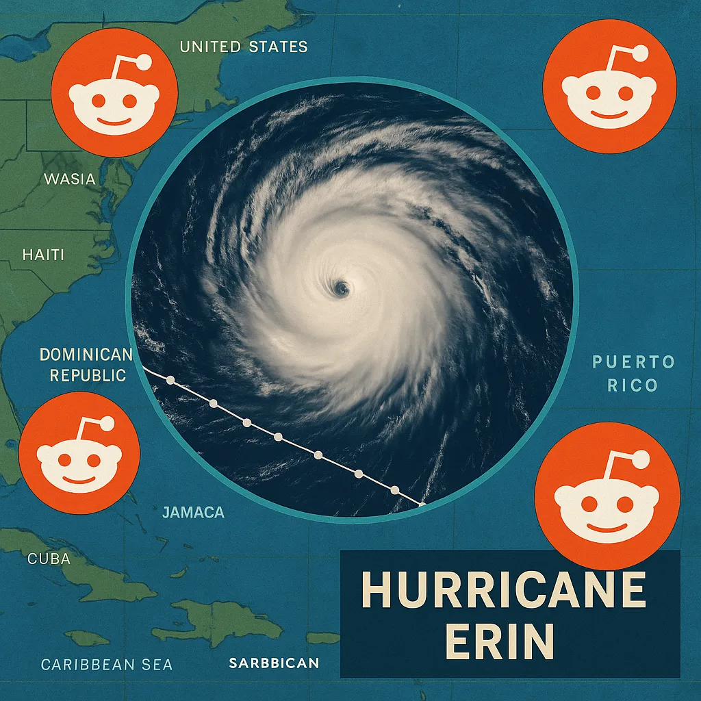
On r/news, multiple threads chronicled Erin’s progression. One prominent post warned “Thousands without power in Puerto Rico as Hurricane Erin pummels…”, noting that despite staying offshore, Erin’s outer bands knocked out power to over 147,000 customers. Commenters shared first-person accounts:
- A Puerto Rico resident reported power and water outages. In contrast, another user in San Juan had calm conditions between rain bands.
- Some voices raised political concerns, pointing out the slow federal response. They tied the storm’s effects to Puerto Rico’s ongoing governance issues.
Another r/news thread celebrated Erin’s rare Category 5 status, with over 12,000 upvotes and 1,100 comments. Users questioned the trajectory uncertainties—would Erin skim the Carolinas or move safely into the Atlantic? They also looked into hurricane dynamics: gt; “As storms increase in size, do they usually keep their wind speeds? Or does the energy spread over a larger area cause a decrease in category?
2.2 r/weather: Meteorological Models and Rip Currents
In r/weather, Redditors dissected model outputs and surf forecasts. A highly rated post called “Hurricane Erin is pretty much the ideal major hurricane scenario” described Erin’s offshore path. While it would not make direct landfall, it would create dangerous surf and rip currents along the U.S. East Coast. Comments in this thread showed a blend of science and local knowledge. Beachgoers guessed drownings were due to high surf. Meanwhile, model fans compared ICON, GFS, and ECMWF projections to assess landfall chances.
A r/weather post showed a satellite image of Erin’s eyewall. People marveled at its symmetry and compact size. Hurricane-force winds were just 30 miles from the eye. Redditors used this to discuss eyewall replacement cycles and potential weakening phases.
2.3 r/hurricane: Real-Time Updates
r/hurricane served as a dedicated real-time update hub. A “5 pm Update” thread gathered advisories from the National Hurricane Center. It tracked Erin’s position, intensity forecasts, and warnings for Caribbean islands. This subreddit’s community valued concise bullet-point summaries:
- Location: 110 miles north of Anguilla
- Intensity: 160 mph winds, 917 mb pressure
- Forecast: Expected to maintain major hurricane status through midweek
r/hurricane may not dive deep into discussions, but it gives quick updates. This helps both enthusiasts and emergency planners stay informed.
3. Personal Narratives and Local Impacts
3.1 On-the-Ground Reports
Reddit’s decentralized structure allowed individuals in affected regions to share first-hand conditions./strong>. In r/news and r/weather, Puerto Rico residents described:
- Intermittent outages: Six short power losses in one day and occasional water service issues.
- **Preparation efforts:** We inspected 367 shelters, and they’re ready to open. FEMA teams are also deployed to help with heavy rains and landslides.
Visitors in San Juan weighed their holiday plans against storm threats. One concertgoer saw calm beaches, even with warnings. This showed a gap between forecasts and reality.
3.2 Surf Culture Perspectives
In r/surfing, a thread titled “breaking news – hurricane erin debunked. waves will be terrible” featured amateur wave forecasts and surfing anecdotes. A user playfully noted, “Every time you talk about surfing a hurricane, it drifts further from shore.” This captures the community’s fun superstition and their relaxed view on risk. A group of surfers is keen on the upcoming swells, despite the warnings. This creates a tension between their desire for excitement and the need for safety.
4. Climate Context: Erin as a Bellwether
Beyond immediate storm impacts, Erin served as a proxy for broader climate discussions./strong>. On r/climate, users discussed how Erin’s quick growth shows storm intensification from climate change. Key points included:
- Warm ocean fueling: Elevated Atlantic sea surface temperatures providing abundant latent heat.
- Statistical rarity: Erin’s timing is rare. Only four Category 5 storms have been recorded before mid-August.
- **Forecast Challenges:** Rapid intensification makes emergency planning harder. It cuts down the time available for warnings and evacuations.
A Redditor pointed out: “Scientists have warned for years that a warmer climate leads to stronger storms. Erin’s overnight surge was one of the fastest recorded.”
This commentary points out how extreme weather shared on social media shapes how people see climate risks.
5. Broader Themes and Takeaways
5.1 Collective Intelligence and Crowd-Sourced Updates
Reddit’s decentralized format enabled a form of crowd-sourced meteorology./strong>. On subreddits, meteorologists, hobbyists, and regular users teamed up. They posted model runs, discussed eyewall dynamics, and shared safety advice. This synergy usually surpassed traditional media in speed and detail, but its reliability varied.
5.2 Risk Perception and Behavioral Insights
Discussion threads revealed diverse risk perceptions./strong>. While some urged evacuation and followed safety advice, others felt complacent. They strolled on the beaches, thinking, “It looks fine,” even with the warnings. Surfers in r/surfing enjoy the rush. This group captures a vibe that blends danger with excitement.
5.3 Climate Change Engagement
Erin galvanized climate-focused conversations. The storm acted as predicted, showing more rapid intensification. This fits the textbook scenarios linked to warming. These discussions often referenced peer-reviewed studies, linking Reddit dialogue to broader scientific discourse.
5.4 Impact on Marginalized Regions
Puerto Rico’s plight highlighted enduring inequities in disaster response./strong>. Threads showed frustration about slow federal aid and infrastructure issues. These concerns connect to past storms, such as Maria. Reddit provided a platform for amplifying local voices and scrutinizing policy responses.
6. Conclusion
Reddit’s response to Tropical Storm/Hurricane Erin showed how well the platform shares real-time updates, personal stories, and scientific discussions./strong>. Erin’s journey spans r/news headlines, r/climate policy talks, meteorology, emergency management, and climate activism. This tapestry of voices not only informed readers but also reflected shifting public engagement with extreme weather in an era of rapid climate change. As Erin drifted away from land, the Reddit archives remained. They tell the story of how a global community united to track and learn from one of the fastest-intensifying hurricanes in the Atlantic.
Categories
Business and finance Climate Entertainment Food and drink Games Health Hobbies and leisure Jobs and education Law and government Other Politics Science Sports TechnologyRecent Posts
Tags